
Jesmond Vale is the southern extension of Jesmond Dene, that has a rich history with industrial archaeology, mature trees, and a variety of wildlife. It is a popular open space for recreation and for walkers.
The Ouseburn flows through it and eventually into the River Tyne. It is mostly administered by the city council ward of South Jesmond. The Ouse Burn flows from the north, through Jesmond Dene then underneath the historic Armstrong Bridge where it enters Jesmond Vale. It then flows in between some allotment gardens alongside the lower edges of Armstrong Park and Heaton Park, flowing over a weir at the white bridge near Greenwater Pool. It then flows under an old stone bridge near The Bluebell pub, and on through Ouseburn Park, past the Newcastle music resource centre. It goes under another stone bridge, then it enters a culvert in Ouseburn Park where Jesmond Vale ends and the Lower Ouseburn Valley starts.
History
Before the 19th century Jesmond Vale was primarily farming pasture land, but by 1846 had a population of 386 people. The village here had three pubs, a farm and a mill beside the Ousburn. There were extensive terraced housing, later perceived as slums. Much of the old village of Jesmond Vale was demolished in 1967 as part of the 'Jesmond Vale Redevelopment Area' scheme, with new accommodation built in the form of Vale House still the second tallest building in Newcastle upon Tyne.
The remains of the mill can still be seen and the Blue Bell public house is still there. During the First World War the Hoppings was held in Jesmond Vale, whilst the Town Moor was in use by the military.
Lost village
The old village of Jesmond Vale used to sit amongst fields in the bottom of the Ouseburn Valley, a tranquil haven away from the bustle of the city. The village had three pubs, a farm and a mill beside the river. The remains of the mill can still be seen, and the leat which fed it can be traced back to the mill dam at Greenwater Pool. Originally a corn mill, it was later adapted to grind flint for use as glaze in the pottery industry. Flint was brought into the Tyne as ballast on cargo ships and was then carted up to the mills on the Ouseburn.
Cradlewell bypass
In the 1990s an ambitious road project bypassed the Cradlewell area of Jesmond replacing the steep gradients of Benton Bank and joining Jesmond Road with the Coast Road. In order to build it several ancient trees were cut down at the northern end of Jesmond Vale. Environmentalist protesters were drawn from all over the country and they delayed construction by constructing tree houses and camping in the tree-tops.
Description courtesy of Wikipedia and Co-Curate.
3rd March 2026

25th June 2025


Jesmond Vale, no. 41, Sinfonia House.
41 Jesmond Vale was built as a rehearsal centre for Northern Sinfonia who then moved over to The Sage (The Glass House) in the early 2000's. Apart from a couple of short lived other uses it has been mostly underused since.
A plan in 2019 to turn it into houses came to nothing. After a suspected arson attack took place earlier this month an application has been made to Newcastle City Council to demolish the building.
29th April 2025


The White Bridge Area.
We have so little rain this year that last years flooded area has dried up. There remains enough debris in the river to flood the area again if it ever rains again.
30th April 2024


The White Bridge Area.
A tree which fell in to the river in 2022 created a dam which has diverted the river around the piece of land between it and the nearby allotments. Scroll down to May 2022 to see the fallen tree blocking the river.
14th July 2023


Sinfonia House.
The old Northern Sinfonia rehearsal space.

Vale House.
1967 by Douglas Wise & Partners with the City Architect. Was once the city's tallest building, but it was overtaken by Hadrian's Tower on Rutherford Street.


Vale Walk.
5th May 2022


The White Bridge.
A fallen tree has caused some damage to the White Bridge and it also appears to be forming a dam.

Ouseburn River.
Another fallen tree just north of the above.

Ouseburn Road.


7th February 2022


Jesmond Vale Allotments.
25th November 2021

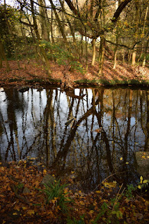
Ouseburn river winding through Jesmond Vale.
20th September 2021

The old Northern Sinfonia rehearsal space.

The Blue Bell pub.

A low Ouseburn river.

The White Bridge looking in need of a bit care.
4th November 2020


Ouseburn river passing under the White Bridge.

The Blue Bell pub.


Northern Sinfonia’s old rehearsal space on Springbank Road.

Ouseburn river winding through Jesmond Vale.


The White Bridge.
19th October 2020


The Blue Bell pub.

Springbank Road.


Repair work to the river bank near the White Bridge.


The White Bridge.
27th September 2014
.jpg)
.jpg)
The White Bridge.
26th March 2009


The White Bridge.
28th April 2008

The White Bridge.
28th March 2008


The White Bridge area.
4th March 2008

The White Bridge area.
26th February 2008


The White Bridge.
19th September 2007

Horse Chestnut tree near the Cradlewell bypass.
11th January 2006


The White Bridge area.
4th December 2005


The White Bridge area.
19th November 2005

The White Bridge area.
1st November 2005

The White Bridge area.
25th October 2005

The White Bridge area.
More Information:
- Sitelines: Jesmond Vale
- Co-Curate: Jesmond Vale
- Wikipedia: Jesmond Vale
- Sitelines: Sandyford, Jesmond Vale House
- Sitelines: Ouseburn Culvert
- Sitelines: Jesmond Vale, bridge abutments
- Sitelines: Jesmond Vale, weir
- Sitelines: Jesmond Vale, footbridge
- Sitelines: Jesmond Vale, river wall
- Sitelines: Jesmond Vale, weir
- Sitelines: Jesmond Vale, Parkville
- Sitelines: Jesmond Vale, Burnville
- Sitelines: Jesmond Vale, Stratford Villas, Nos. 1 - 7
- Sitelines: Jesmond Vale, Laheen
- Sitelines: Jesmond Vale, Blue Bell Public House
Historical interest:
- Sitelines: Jesmond Vale, Princess Royal Public House
- Sitelines: Jesmond Vale, Travellers Rest Public House
- Sitelines: Jesmond Vale, Vale Mission Church (St. Christoper's)
- Sitelines: Jesmond Vale, Vale Mission Hall
- Sitelines: Jesmond Vale, Methodist Chapel New Connexion
- Sitelines: Jesmond Vale, Sunday School
- Sitelines: Jesmond Vale, Woodbine Terrace
- Sitelines: Jesmond Vale, stepping stones and ford over Ouse Burn
- Sitelines: Jesmond Vale Flint Mill
- Sitelines: Jesmond Vale, Mill race
- Sitelines: Jesmond, WW2 Roadblock
- Sitelines: Sandyford, Jesmond Vale House
- Sitelines: Jesmond Vale, weir on Ouse Burn
See my other photos around Jesmond Vale:
- Sandyford
- Sandyford, Dinsdale Place Graffiti
- Armstrong Bridge
- Armstrong Park
- Armstrong Park, The Shoe Tree
- Heaton Park
- Heaton Park, House of Adam
- Jesmond Dene
- Jesmond Dene, Banqueting Hall
- Jesmond Dene, Deep Dene House (Fishermans Lodge)
- Jesmond Dene, Pets Corner
- Jesmond Dene, Reid Park Road, St. Mary's Chapel
- Heaton (2005-2023)
- Heaton (2024 onwards)
- Jesmond
- Shieldfield
No comments:
Post a Comment