
Photos of the Ouseburn area taken between 2020 and 2023. A lot of the 2020 photos were taken during exercise periods while in Covid-19 lockdowns.
14th December 2023


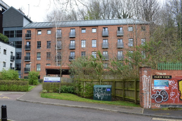
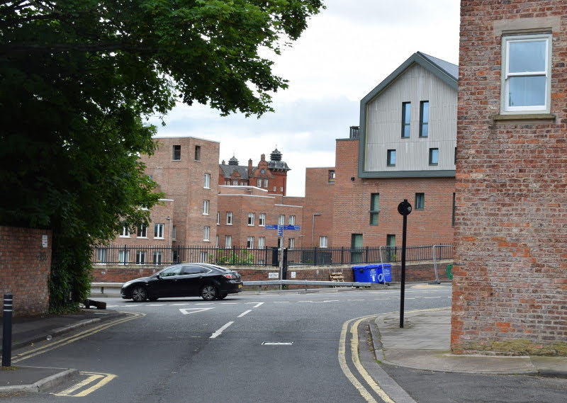
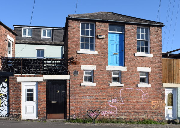
Maling Street.
The former Stables Buildings in Maling Street, which was a well-known graffiti wall, is being converted to create three new units with shops, offices, and a restaurant.
10th December 2023

Ford Street.
Car sales on the site of the old garage.

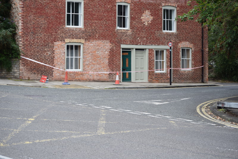
Cut Bank/Lime Street junction.
11th September 2023


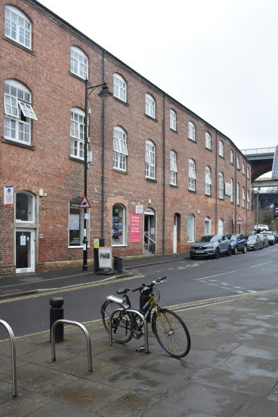
Lime Street, No. 36, Flax Mill (Cluny Warehouse).
The last photo features a plaque in memory of Eric Larkham who was one of the founders of the Ouseburn Trust and a lovely guy.


Maling Street Demolition.

Seven Stories Boat.
Looking a bit less shipshape recently.
14th July 2023


Lime Street Slipway.
14th July 2023

Byker Bank Allotments.


Lime Street, No. 36, Flax Mill (Cluny Warehouse).
Built as a flax mill in 1848 on the site of an earlier corn mill, to the design of John Dobson for the firm of Plummer and Cooke, who previously owned the flax mill on the adjacent site which became Northumberland Lead Works.
Flax was used to make linen and sail cloth. Originally steam powered the adjacent freestanding, recently restored chimney forms part of the original Dobson complex. Its use as a flax mill was short. In 1866 it was bought by Proctor and Sons and converted to a flour mill.
The building was extended in the mid 1870s when two brick warehouses were constructed - one for flour, the other for grain. The complex is shown on Ordnance Survey second edition as "Northumberland Mills". Then taken over by Henry Leetham and Sons in 1900.
A Miss Carr apparently lived in the garden house next to the big chimney and was employed by Leethams to test each batch of flour by baking small loaves of bread in her oven.
The flour mill stood empty for many years until it was taken over by McPhersons Wine and Spirit Merchants in the 1920s, who stored bonded whiskey under the brand name of Cluny.
Now internally divided, it has a variety of users, mainly craftspersons or artists and a café bar.
Sandstone ashlar, later brick additions and attic storey date to 1870s, Welsh slate roof. The road between mill and chimney is at a much higher level than the internal cobbled yard into which the former coal shoots opened. One of the shoots retains its original metal shutter.
Grade 2 Listed. Source: Sitelines.


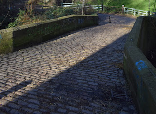
Lime Street Slipway.
Lime Street.


Lime Street, no. 21.
Plans have been approved for this site and these buildings will soon be demolished.


Lime Street, nos. 7 to 17.
Plans have been approved for this site and these buildings will soon be demolished.
13th June 2023

Lime Street.
24th May 2023


Maling Street and The Ouseburn.
9th April 2023


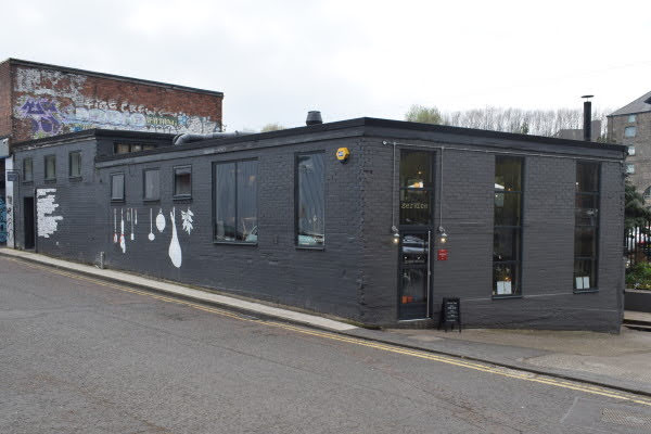
Foundry Lane.


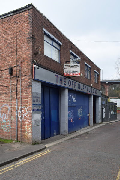


Foundry Lane, Off Quay Building.

Foundry Lane, Fearons Garage.


Foundry Lane Workshops.

Cut Bank.
18th April 2023


Maling Street.
9th April 2023

Ouseburn Culvert, original entrance.
31st March 2023

Stepney Road, Nido Student.

Stepney Road, Uptin House.


Stepney Road.


Fallen Tree.


Crawford's Bridge.
The oldest of the surviving bridges crossing the lower Ouseburn. Built early to mid 18th century of coursed, squared sandstone. The name derives from Thomas Crawford who owned a number of properties in the area in the early C19.
Segmental arch recessed under chamfered abutment; parapet courses follow slope of road, high at centre. Chamfered coping to parapet ending in low piers, with pyramidal coping to that at south-west, and continuous stretch of wall about three metres at north-east.
Stone drains from road surface protrude through north-east and south-west faces. Mason's mark - diagonal cross in square - above road at centre of west parapet, O.S. bench mark above road at centre of east parapet.
Source: Sitelines.

Ouseburn Bandstand.


Lime Street slipway buildings.
Including remains of an old public toilet.


Upper Steenbergs.
The large scale warehouses of this yard still dominate Lime Street. There was a state-of-the-art slaughterhouse built by the Co-operative Society. Animals brought into the cattle sanatorium at Lower Steenberg's Yard were slaughtered here or sent to the cattle market. The waste products were flushed into the Ouseburn.
There was also a boot making works/shoe repairers, also built by the Newcastle Cooperative Society. Now converted into residential flats, workshops, Ouseburn Partnership Office and an indoor riding ring for Stepney Bank Stables. The southern most building was bombed during the War.
Source: Sitelines.

15th March 2023

The Ouseburn and Maling Street.
8th March 2023

Lime Street, Phoenix Martial Arts.
Lime Street.
21st January 2023

Ford Street, Derelict Building.
A derelict building behind the scrap yard on Cross Street.
4th November 2022


Maling Street, The Tyne Public House, beer garden.
11th October 2022


Stepney Bank, John Wood's Stepney Pottery.
Mentioned in directories of 1877 to 1912. Built to replace the earlier works on the other side of Stepney Bank, demolished to make way for Byker Bridge.
The firm made white, coloured and brown earthenware. The address was 36 Stepney Street. John Wood bought up stock of biscuit ware from Sewell and Company of St Anthony's pottery when they ceased trading in 1878, and then printed it with his designs.
In 1892 the firm became a limited company. A description of 1890 says that the pottery covered 3,500 square yards. It had furnaces, warehouses, showrooms, salerooms and an office. Some 70 people were employed. The pottery was in operation until 1912.
Only three buildings survive - the western end of the block fronting onto Stepney Bank is the caretaker's or Keeper's House - the oldest surviving house in the Ouseburn, then there is the stables (now roofless), mixing house, brownware drying room and packing house. The packing house bears the name of 'Steenberg' who opened the premises after Curries haulage who used the site as a stables and warehouse through much of the 20th century.
Source: Sitelines.

Stepney Bank, sightseeing bus.

Stepney Bank, Arch 3.


Stepney Bank, Arch 2.


Lime Street slipway buildings.


Lime Street, nos. 7 to 23.
25th August 2022

Lime Street.
17th August 2022


Stepney Road, Uptin House.
25th July 2022

Ford Street Scrapyard.
13th July 2022

Taken from Saltmeadows Riverside, Gateshead.
3rd July 2022
Lime Street.
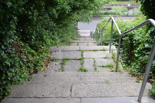


Lime Street Steps.
Access to and from St. Ann's estate has improved with a new path linking the steps on Lime Street to the estate.
28th June 2022


Upper Steenbergs.


Lime Street, Seven Stories.
A large flour mill designed by Gibson Kyle and built for Proctor and Sons, who at that time owned the adjoining former flax mill, built 1873-4.
By 1896 the mill was owned by a family of miller's named Leethams, who also owned the adjacent property. The name Leethams can still be seen painted onto the gable end of the building. Until the 1920s there was an internal walkway through the two buildings. Leethams left 1916 and various small businesses utilised the building.
From the 1940s to 1980s the building was owned by a farmer's co-operative, Farmway, and used to grind cattle feed.
During the 1970s it was sold to the Revolutionary Workers Party to house a printing press. Basic remedial work was carried out on what had become a derelict building. Now converted into the Centre for Children's Books [2004].
Brick with ashlar dressings and rear basement to river. Welsh slate roof. 4 storeys, 3 bays and 2 bays set back at left. 3 high vehicle entrances have segmental brick arches on 2 cast iron columns; outer brick piers have cast-iron fenders and stone impost blocks; iron cladding to brick springers over central columns.
The maker's mark (Toward of St Lawrence) can be seen on the cast iron columns. Within the arches are double doors under wood lintels. Rear elevation to Ouseburn has central gabled hoist.
Grade 2 Listed. Source: Sitelines.

Lime Street, nos. 1 to 5 (Coal Merchants).
Detached three-storey building on corner of Lime Street and Cut Bank.
This was the coal depot of J.T. Potts. The Potts family acquired the property in 1898. Trade directories before this date list the property as "Montague Coal Depot" under the ownership of S. Wood. After 1898 the business is listed as T. Potts and Co, Coal Merchants. It was still in the Potts family in 1929.
The offices were on the ground floor, with residential rooms above. Coal was stored in the yard to the rear. Access into the yard by coal wagons was through a passageway shown on the Ordnance Survey second edition.
Source: Sitelines.
16th June 2022


Stepney Bank, John Wood's Stepney Pottery.
28th May 2022


Ford Street, Brinkburn Street Brewery.
In 1936 workshop buildings were built for the wheelwright Cartright on the site of the packing house for the Ford A Pottery.
The Ordnance Survey fourth edition 6" to one mile plan of 1942 labels the building as 'Carriage Works'. The fifth provisional edition 1:2500 of 1952 labels it as a 'Coach Works'. The building has latterly been in use as R and J Ince Builders and Timber Merchants and DS Motors and is now The Brinkburn Brewery.
Quite an attractive industrial building, brick single storey workshop with a square chimney which served the carriage works furnace. Two storey office at the the eastern end. Inside, the sandstone north wall of the previous pottery packing house survives and so does the tunnel which linked the packing house to Ford A Pottery.
Source: Sitelines.
25th May 2022


Maling Street, The Tyne Public House (Ship Tavern).
The Tyne public house, originally known as the Ship Tavern, has been an important part of the Ouseburn since the 19th Century.
The Ship Tavern was opened in 1850 only to be destroyed by fire before 1895, when the pub was rebuilt as it stands today. This two storey building has decorated sandstone pillars and arched ground floor windows set in a brick face. The windows have leaded stained glass upper panes, and lower panes engraved ‘Ship Tavern’. The pub is known locally as the ‘Bottom Ship’.
Source: Sitelines.
20th May 2022


Lime Street.

Quality Row.

Lime Street, No. 51, 'Wire Horses'.
2002 by Daniel Reed. Galvanised steel wire frame horses apparently emerging from the wall. The building is the riding arena for Stepney Bank Stables. Commissioned by the Ouseburn Trust.
Source: Sitelines.
24th April 2022


Lime Street.


Stepney Bank.

Stepney Bank Stables.
This was historically one the main access routes into the valley. Horse and cart was the traditional form of road haulage in the valley. These stables were established in 1897 for the Global Parcel Express Company. At the time of writing they are now the only urban working stables in Newcastle.
Source: Sitelines.

Stepney Bank, Little Buildings.
A live music venue with a door to nowhere and a humorous heritage plaque.


Upper Steenbergs.
26th March 2022


Lime Street.
The slow demolition and clearance of land around the steps up to St Ann's Court continues. It's the first time I've noticed the steps fenced off.

Stepney Bank, The Ship Inn.
The Ship Inn is a popular and attractive traditional working class pub located in the heart of the Ouseburn, lying beneath Byker Bridge. In the past it was popular with the local abattoir workers.
The building was originally part of a terrace in Stepney Bank which was destroyed during the 1930s. It has been designed relatively simply. It has two storeys and an attic above with two dormers. The ground floor has large windows with painted stone lintels and sills.
Source: Sitelines.
17th March 2022


Stepney Bank, The Ship Inn.
13th January 2022


Crawford's Bridge.
The oldest of the surviving bridges crossing the lower Ouseburn. The name derives from Thomas Crawford who owned a number of properties in the area in the early C19.
Early/mid C18. Coursed squared sandstone. Segmental arch recessed under chamfered abutment; parapet courses follow slope of road, high at centre. Chamfered coping to parapet ending in low piers, with pyramidal coping to that at south-west, and continuous stretch of wall about three metres at north-east.
Stone drains from road surface protrude through north-east and south-west faces. Mason's mark - diagonal cross in square - above road at centre of west parapet, O.S. bench mark above road at centre of east parapet.
Source: Sitelines.
10th November 2021


Stepney Bank, Little Buildings.
17th September 2021


James Place Street, Cumberland Arms.
The Cumberland Arms was first licensed as a beer house in 1862. The present building dates from 1899, rebuilt following collapse of the earlier building during renovations.
A Mr James Cackett was engaged to make internal alterations - increasing the bar area and adding a new façade. Nos. 2 and 3 James Place were incorporated into the public house. This plan survives largely unchanged today.
The pub was once owned by 'Jocker' Wood (1854 - 1937), a popular sportsman and publican. In 1919 the pub was purchased by Wilkinson's Pinestreet Brewery of Elswick, and underwent alterations in 1935.
Source: Sitelines.
13th September 2021

Ouseburn Viaducts.

Overflowing litter near The Ship Inn.

Ouseburn Bandstand.
Anyone ever saw this being used?


Lime Street, No. 36, Flax Mill (Cluny Warehouse).
Lime Street, nos. 1 to 5 (Coal Merchants).

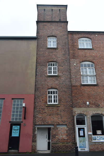
Lime Street Chimney.
A chimney constructed as part of the original steam operated Dobson-designed flax mill (now known as Cluny Warehouse).
The huge brick-arched flue leading from the chimney to the mill was revealed under the road during works by Transco in the 1990s.
After the chimney went out of use, circa 1900, the base was converted into a blacksmith's workshop. The door is part of the original design, giving access to the chimney for cleaning and maintenance. The top of the chimney was removed prior to World War Two and the chimney void infilled. The chimney featured in the intro of the classic TV show The Likely Lads.
Source: Sitelines.
5th September 2021


Stepney Bank, Ancient Place.
Part of Winged Tales of the North art trail.


Lime Street, no. 51, 'Wire Horses'.


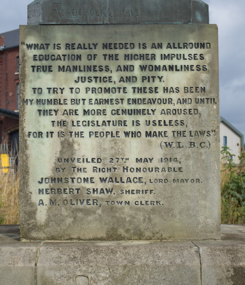
Horatio Street, William Coulson Statue.
The memorial fountain and statue is located on Horatio Street.
It was originally located by the Haymarket when unveiled by the Lord Mayor on the 27th May 1914. Because of congestion by the Haymarket the statue was moved.
Colonel Coulson was a founding member of the Humanitarian League, formed in England in 1891. The League opposed both corporal and capital punishment; and was also a forerunner to the modern animal rights movement, campaigning for the banning of all hunting for sport, and vivisection. The Humanitarian League was discontinued in 1919.
Grade 2 listed. Source: Co-Curate
8th August 2021

The Ouseburn Viaduct.
Ouseburn Viaduct is the sister viaduct of another at Willington. It is a wrought iron reconstruction of the original laminated timber structure, built by John Green in 1837-9. It is 918 feet (280 metres) long, with four stone approach arches and five main arches, carrying the railway 108 feet (33 metresetres) above the Ouseburn. The stone piers carried the original timber structure and were probably designed to be reused when the timber was replaced.
Grade 2 Listed. Source: Sitelines.
7th August 2021

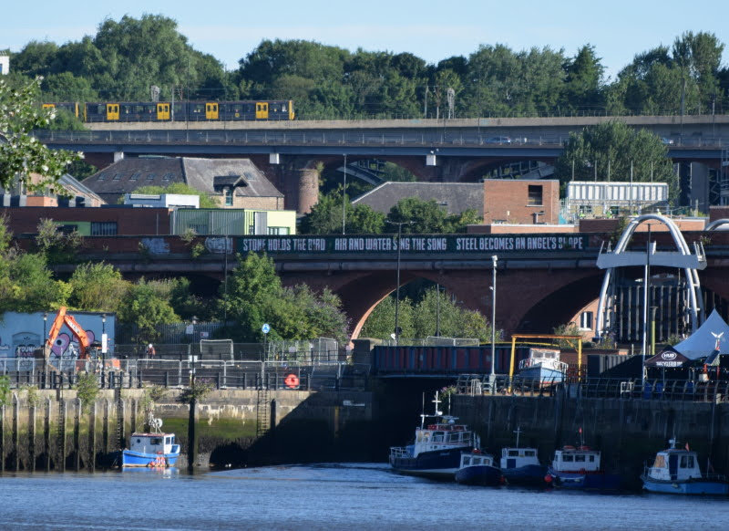
Byker Metro Bridge.
Byker Metro Bridge (also known as Byker Viaduct) was constructed 1978-1979 and was purpose built for the Tyne and Wear Metro system, which opened in 1980. The viaduct carries the metro over Ouseburn Valley between Newcastle city centre and Byker.
Source: Co-Curate.
2nd July 2021


Ford Street, Brinkburn Street Brewery.

Maling Street.

A section of Glasshouse Bridge.
7th June 2021


Byker Bank/Cut Bank.


James Place Street, The Cumberland Arms.


Lime Street, Seven Stories.

Lime Street.


Stepney Bank Stables.

Ancient Place on Stepney Bank.
Part of Winged Tales of the North art trail.

Stepney Bank, Ship Inn.


Stepney Bank.

Stepney Road.


Lime Street, No. 36, Flax Mill (Cluny Warehouse).

Maling Court rooftops from Byker Bridge.

Maling Street.
30th May 2021

Maling Street, The Tyne Public House (Ship Tavern).
5th May 2021

William Coulson Statue.
23rd April 2021

Back Maling Street.
Panoramic photo taken on Ford Street.
4th April 2021


William Coulson Statue.
10th February 2021


Grafitti on Maling Street.

Shift starts at Lower Steenbergs Yard.

Old entrance to Lower Steenbergs Yard.
26th January 2021

Maling Street, The Tyne Public House (Ship Tavern).
27th November 2020

Maling Street, The Tyne Public House (Ship Tavern).
3rd August 2020

St. Lawrence Road, Free Trade Inn.
The former beerhouse probably opened shortly after the introduction of the 1830 Beer Act.
Bought by Henry Davidson of the White Lion Brewery in 1888. Rebuilt in 1896 to designs by Oswald and Son. Their original design had two large decorative gables in Queen Anne revival style with ball finials and hooded canopy over the door. Inside the bar had a V-shaped counter to echo the shape of the building. There was a club room upstairs. Henry Davidson opted for a cheaper design which increased the size of the tenant's accomodation and replaced the proposed club room with bedrooms.
The façade hardly had any decoration apart from facings round the windows and a parapet inscribed with the name Free Trade. In 1899 Matthew Wood, brewer from South Shields bought it. In 1911 there were structural alterations. The tenant's kitchen became a parlour, the bar counter was extended and the family room became part of the main bar.
In 1919 the Free Trade became a Newcastle Breweries pub. In 1937 more internal partitions were removed. It almost closed in 1947 when Newcastle Breweries applied to transfer the licence to a new pub to be built in Sackville Road. The Free Trade was not granted a full publican's licence until 1963. It is still a free house.
Little of the original interior survives apart from the basic form of the bar counter and part of the back bar fitting.
Source: Sitelines.

Lower Steenbergs Yard.


The River Ouseburn meets the River Tyne.


Horatio Street, Blenkinsopp-Coulson Drinking Fountain.
Drinking fountain and portrait bust. 1914; signed Alexis Rudier and bust dated 1912.
Sandstone, pink granite and bronze. Wide stone base; granite plinth and basins; sandstone pedestal with long inscription commemorating W.L. Blenkinsopp Coulson and his efforts to help the weak and defenceless 'among mankind and in the animal world'.
Larger-than-life bust has drapery wrapping round pedestal. Has two fountain bowls - one for humans, one for animals. The fountain originally stood in Percy Street before being moved to the Haymarket then in 1950 to its present site.
Statue to William Lisle Blenkinsopp-Coulson 1841-1911. Erected by public subscription. Bronze bust by A. Rechbers and cast by Alexis Rudier, Paris, surmounts a sandstone pedestal. There are two new rather crudely carved animal heads. The originals will have faucets discharging from the mouths of the beasts. There is now no water supply.
Grade 2 Listed. Source: Sitelines.
10th July 2020

The Toffee Factory.
The site was developed in the 1870’s as a location where livestock (cattle, sheep and pigs) imported from overseas could be held for twelve hours before being released to local markets. When these imports declined in the early 1900s, the large multi-storey building opposite was converted for use as a Maynards toffee works.
You can see the chimney is made of lighter, newer bricks than the original building and probably dates from 1906 when the toffee works began operation. The firm of Maynards had recently merged with a local confectionary maker called John Vose, and their new toffee works at Ouse Street was a feature of this area until the early 1970s. Their elegant chimney continues to be a landmark to this day, despite the damage caused by a severe fire in the 1990s.
For over 200 years the banks of the Ouseburn have been extended into the river, and from the 1820s a quay wall was built to support riverside industries. The 1868 Ordnance Survey shows corn mills and brick works once occupied this site.
The former Maynards toffee factory now has 24 office units varying in size between 500sq ft and 800sq ft, units aimed at the commercial creative market such as graphic designers, software engineers and architects. The building is home to 160 staff. The remaining walls and floors of the existing Victorian building were preserved. The factory, which was under threat of demolition, is a throwback to when the Ouseburn Valley was at the heart of Tyneside’s industrial revolution.
Source: Newcastle Heritage.


Covid measures at The Tyne Pub.
7th July 2020


Covid measures outside the sandwich shop on Maling Street.
28th May 2020


St. Lawrence Road, Free Trade Inn.
26th March 2020

Maling Street, The Tyne Public House (Ship Tavern).


The Toffee Factory.

Cut Bank, glasswork flues.
These remains of a brick furnace reflect the importance of the Ouseburn glass industry. More accurately they are five flue arches belonging to the former Liddell-Henzell Bottle Works, which was founded in the 19th Century. The works were situated next to the Cut Bank Bridge over the Ouseburn.
Source: Sitelines.

The Ouseburn Barrage.

Scrapyard on Ford Street.

Lime Street, No. 36, Flax Mill (Cluny Warehouse).


Looking towards the Quayside.
9th March 2020

Lime Street.


The River Ouseburn.


Lime Street, No. 36, Flax Mill (Cluny Warehouse).

Ford Street, Walker Road.


Byker Metro Bridge.

Ouseburn Road.


Back Maling Street.


Ford Street.

The Ouseburn Viaduct.

A performance space under the Ouseburn Viaduct.
6th March 2020


Lime Street, Pigeon Crees.
The two pigeon crees on either side of Lime Street greatly add to the aesthetic character of the Lower Ouseburn Valley. They highlight the long tradition of this local pastime. The crees are recently built timber structures nestled amongst the trees on the banks of the Ouseburn. Their blue and white designs make them quite distinctive.
Source: Sitelines.


Lime Street.


Lime Street, Chimney.

Industrial units near Foundry Lane.

Maling Street.

Ouseburn Farm.
Byker City Farm was set up by local people in 1976, so that children living in the city had the chance to working with farm animals. The Farm was forced to close in 2002, but renovated reopened as Ouseburn Farm in 2009.
Source: Co-Curate.

An old cobbled street behind The Ship Inn.

Byker Bank.

Stepney Bank, Ship Inn.


Stepney Bank, Ancient Place. Part of Winged Tales of the North art trail.

Stepney Bank.


Magpies under Byker Bridge.

Byker Metro Bridge.

The River Ouseburn.

Ouseburn Farm.


Foundry Lane, steps up to The Cumberland.

Lime Street Steps.


Lime Street, No. 36, Flax Mill (Cluny Warehouse).

A decorated tree on Foundry Lane.


Byker Bank/Cut Bank.


Maybe Lime Street, I can't remember where I took these two photos.
26th February 2020


Maling Street.
14th January 2020


Near The Free Trade Inn looking west towards the Quayside.
7th January 2020

Maling Street.

Back Maling Street.

Maling Street.
30th September 2019

The Ouseburn.
More Information:
- Ouseburn Trust Homepage
- Wikipedia: Ouseburn
- Wikipedia: Ouseburn Valley
- Ouseburn Trust: Victoria Tunnel
- Historic England: Lower Ouseburn Valley, Newcastle
- Co-Curate: Ouseburn (river)
- Co-Curate: Ouseburn Valley
- Co-Curate: Ouseburn Historic Timeline
- Sitelines: Lower Ouseburn Valley Conservation Area
- Sitelines: Ouseburn, waymarkers
- Sitelines: Cumberland Arms, 'Seats with a View'
- Sitelines: Ford Street, Maling Pottery packing house
- Sitelines: Ford Street, Maling's Ford A Pottery
- Sitelines: Ford Street, Maling's Ford A Pottery, tunnel
- Sitelines: Ouseburn Culvert
- Sitelines: Ouseburn Lead Works
See my other photos around Ouseburn:
- Ouseburn (2005 to 2012)
- Ouseburn (2014 to 2018)
- Ouseburn (2024 onwards)
- Ouseburn Barrage
- Ouseburn Farm
- Ouseburn Schools & Ballast Hills Burial Ground
- Ouseburn Street Art & Graffiti
- Ouseburn, Ford Street, Scrapyard Fire (2011)
- Ouseburn, Hume Street, Ouseburn Quays (Construction)
- Ouseburn, Ouse Street, Lower Steenberg’s Yard (Construction)
- Ouseburn, Ouse Street, Lower Steenberg’s Yard, Toffee Factory
- Ouseburn, The Malings (Construction)
- Ouseburn, The Victoria Tunnel
- Battlefield
- Byker (2005 to 2018)
- Byker (2021 to 2024)
- Heaton (2005-2023)
- Heaton (2024 onwards)
- Sandyford
- Shieldfield
No comments:
Post a Comment