
Photos taken around City Road over the years. There are links to photos of specific places on City Road at the bottom of the page.
December 2025


Former Salvation Army Mens Hostel.
1974 by Ryder and Yates. Replaced a nearby Men's Palace or itinerants hostel that had been demolished.
Sweeps back from the road in an asymmetrical curve of brick and glass. Narrow windows. Twentieth Century Society Building of the Month January 2010 - the building is curved and linear in blue brindle brick. The blue brickwork was also used inside. Gordon Ryder used a curve to replacate the curve in the proposed road improvement.
The larger three storey range has bedrooms on ground and second floors and communal rooms on the first. 184 men could be accomodated. There were also day rooms, a restaurant, facilities for the elderly and a small hospital. The steel windows, which originally had bright green shutters, were designed so that three bedroom units could be from two if required. The central entrance has a curved access ramp and boomerang-shaped canopy on columns. The rooftop penthouse for the superintendent has an arched roof. The surrounding grounds are landscaped into 'earth sculptures'.
Source: Sitelines.
13th July 2025

Pedestrian Crossing Near Miss.
All the amazing work done by surgeons to save my life last year was almost undone in a second by the idiot driving this taxi. The photo was taken after I had just crossed the pedestrian crossing a few yards to the east of where this picture was taken. While on said crossing I could see the taxi approaching from the east and refusing to slow down and stop for me. It wasn't like I had just stepped out in front of it, he had 100 yards or more to see me on the crossing. It then proceeded to just swerve around me on the crossing at around 30mph and missed me by a few feet.
8th June 2025


New Pedestrian Crossings.
Long overdue as this is an very dangerous spot for pedestrians
17th September 2024


City Road, Hotel du Vin.
Originally built as the offices of the Tyne Tees Steam Shipping Company. Then known as Allan House after the company who has occupied the building in later years. Converted in 2007-8 to the Hotel du Vin. Built in red brick, of three bays, the centre of which projects slightly forward and is marked by a parapet at roof level. Slate roof. Original Georgian fenestration survives. Site lies over the Victoria Tunnel.
Source: Sitelines.
4th July 2023

The Now Derelict Barclays Bank.
Barclays is moving into Pilgrim Street's office complex Bank House.
29th December 2022


City Road, Hotel du Vin.
28th August 2022


Sallyport Crescent.
Sallyport Crescent is a terrace of houses off City Road. It is close to, and overlooked by Sallyport Tower. The crescent is the earliest surviving council-built houses in Newcastle, having been constructed in 1913-1916, under the supervision of Mr Halford, Property Surveyor to the Corporation.
The crescent is made up of 44 flats, with rear yards enclosed by low walls. The houses were renovated in the mid-1980s and the gable end (north end) has the keelmen inspired mural 'Mural in Coloured Bricks' by Robert Olley (1986).
Source: Co-Curate.
8th August 2022


City House.
The fine structure of City House is a landmark and it, along with Pandongate House on the adjacent corner, dominates the streets on to which it fronts. The 3.5 storey Victorian building with a curved south west corner is predominantly red brick and has large arched windows and several top floor windows are capped by gables.
The building has a granite plinth and a ground floor of red sandstone. The south west corner has a projecting central section with a more elaborately articulated first floor window and is topped by a tall shaped gable. City House now hosts homeless charity Crisis.
23rd July 2022


Mission House.
Former Wesleyan Mission House dating to 1867. Now flats, briefly a restaurant if I recall correctly.


True Student Newcastle Opto.
Student accommodation built on the old Tyne-Tees Television site.


Mansion Tyne.
Student accommodation built on the old Tyne-Tees Television site.

Welcome Home Apartments.

7th July 2022

Taken In Gateshead.
A small slice of City road visible from outside The Baltic.
11th June 2022

Pandongate House.
See just below for more info.

8th April 2022

Pandongate House.
The structure of Pandongate House dominates the streets on to which it fronts, along with City House on the adjacent corner.
The four storey large red brick building has large round arched windows on its ground floor, with stone surrounds and quoins and terracotta concentric circle designs beneath. The curved south east corner has three similar windows which are as tall as those on the main elevations but much narrower. The bays of the south and east elevations are divided by brick projections. The block has been converted to flats but continues to hold its place as a fine landmark in its area.
Source: Sitelines.

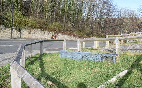
G.P.O. Marker Post.
General Post Office (GPO) marker posts were installed from the Victorian era until 1969, when the GPO ceased to exist. The marker posts often contain the royal cypher of the reigning of the time on them (like the post-boxes do) and were used to denote location of telegraph cables and thus are no longer in use as people no longer send telegrams.
1st April 2022

Sallyport Crescent.
17th February 2022
Ouseburn Waymarker.
On the corner of City Road and Cut Bank one of the four Ouseburn waymarkers has been toppled.
13th January 2022

Mission House.
2nd January 2022

City Road, nos. 15 to 23.


The Weights and Measures Building.
Brick building with arched windows and doorway, stone dressings and slate roof. Decorative gable and chimney stack. Adjacent stone retaining wall and stairs from City Road to Causey Bank. Shown on Ordnance Survey second edition. Last industrial use was J and L Metals. Now converted to apartments. Raised by one floor in height and new roof. Lies directly on top of medieval town wall.
Source: Sitelines.


Mission House.


Hotel du Vin.
14th December 2021

City Road, no. 31.


The Weights and Measures Building.


City Road, nos. 15 to 23.

Steps east of St. Ann's Church.


Croft Stairs, Sinclair's Cooperage.
This former gardener's cottage once lay within the walled garden of the Barber Surgeon's Hall. It is first shown on Corbridge's map of 1723.
Its lower courses were constructed of rough unmortared sandstone. It was rebuilt, probably in 18th century with brick at first storey level. Welsh slate roof with brick chimneys. Sash windows, mostly renewed. In 1698 Celia Fiennes wrote of the Hall "a pretty garden walled in, full of flowers and greenes in potts and in the borders". The Barber Surgeons Hall was demolished in 1847 to make way for the railway bridge, but the gardener's cottage survives and has been restored and is home to a firm of accountants.
Grade 2 Listed. Source: Sitelines.


Former Salvation Army Mens Hostel.

Premier Inn.


Pandongate House.

True Student Newcastle Opto.


Gibson Street Flats.


C3 Newcastle Pentecostal Church.
10th November 2021


Barclays Wealth and Investment Management office.
A glass-clad office block by Ryder built as part of the Quayside regeneration from 1987 to 1998 by Tyne and Wear Development Corporation.

True Student Newcastle Opto.

Pandongate House.


City House.
23rd April 2021

Deserted Keelmans Hospital in the background.

Mission House.

Ouseburn Gateway.
On the junction with Cut Bank is the former Ouseburn Electricity Sub Station which was converted to apartments and renamed Ouseburn Gateway.
4th April 2021

City Road, Hotel du Vin.
10th February 2021

City Road, Hotel du Vin.
3rd September 2020


Former Salvation Army Mens Hostel.

7th April 2017

Former Salvation Army Mens Hostel.
16th May 2015

Former Salvation Army Mens Hostel.
29th September 2014
.jpg)
Mission House.


Mansion Tyne.
Student accommadation and apartments built on the site of the now demolished Tyne Tees Television Studios.

The Weights and Measures Building.

Pandongate House.


Looking west towards the city centre.

Old Manors Railway Station Entrance.


Derelict Barley Mow Public House.

The Salvation Army Mens Hostel.

8th February 2010

Tyne Tees Television Studios.
Scaffolding erected in preparation for demolition.
19th November 2007

Construction of new office block.
8th June 2007

Former Salvation Army Mens Hostel.

Gibson Street/Blagdon Street flats.
25th May 2007

The Egypt Cottage Public House.
The Egypt Cottage was situated at 117 City Road. This pub was next door to ITV's studios and used as a sort of green room for the musicians who were about to play on The Tube TV show. It is where Michael Hutchence and Paula Yates first met.
Source: Closed Pubs.

Former Salvation Army Mens Hostel.
25th April 2007

"The Tube" at Tyne Tees Television Studios.
2nd March 2007

The Egypt Cottage Public House.
17th January 2006

Tyne Tees TV Studios and The Egypt Cottage Public House.
1985

The Golden Lion, City Road/Tyne Street 1985.
Photo Courtesy of Newcastle Libraries
1965

Corner Tower, City Road 1965.
Photo Courtesy of Newcastle Libraries
1929

Photo Courtesy of Newcastle Libraries
1908

Photo Courtesy of Newcastle Libraries

Photo Courtesy of Newcastle Libraries
1900

Photo Courtesy of Newcastle Libraries
More Information:
- Sitelines: City Road, Salvation Army Men's Hostel
- Sitelines: Cut Bank, Ouseburn Sub Station
- Sitelines: Nos. 1-3 City Road, City House
- Sitelines: No. 5, City Road, Pandongate House
- Sitelines: Nos. 25-29, City Road, printing works
- Sitelines: No. 147, City Road, Mission House
- Sitelines: Gibson Street, Blagdon Street, flats
- Sitelines: City Road, office block
Historical interest on City Road:
- Sitelines: City Road, Public Baths and Wash Houses
- Sitelines: City Road, Egypt Square
- Sitelines: City Road, Egypt House
- Sitelines: City Road, Royal Jubilee School
- Sitelines: City Road, Wesleyan Mission Chapel
- Sitelines: City Road, Wesleyan Methodist Chapel
- Sitelines: City Road, Tyne Wire Works
- Sitelines: City Road, St. Anne's Wire Rope Works
- Sitelines: City Road, Brush Manufactory
- Sitelines: City Road, Tyneside City Bakery
- Sitelines: City Road, Quayside, engine house
- Sitelines: City Road, Soap Manufactory
- Sitelines: City Road, well
Historic public houses/breweries on City Road:
- Sitelines: City Road, Albion Inn
- Sitelines: City Road, Rose and Crown Public House
- Sitelines: City Road, Egypt Cottage Public House
- Sitelines: City Road, London Tavern Public House
- Sitelines: City Road, Druid's Arms Public House
- Sitelines: City Road, Butcher's Arms Public House
- Sitelines: City Road, Northumberland Brewery
- Sitelines: City Road, Pheasant Public House
- Sitelines: City Road, Yacht Inn
- Sitelines: City Road, Duke of Connaught Public House
- Sitelines: City Road, High (New) Barley Mow Inn
See my other photos around City Road:
- City Road, Barley Mow/Stereo Nightclub
- City Road, Holy Jesus Hospital
- City Road, Keelmans Hospital
- City Road, Tyne Tees TV Studios
- City Road, Tyne Tees TV Studios (Demolition)
- Battlefield
- Battlefield, Breamish Street, St. Ann's Church
- Battlefield, Crawhall Road, Norris House
- Ouseburn (2005 to 2012)
- Ouseburn (2014 to 2018)
- Ouseburn (2020 to 2023)
- Ouseburn (2024 onwards)
2 comments:
The GPO marker post is documented at https://gpo-markers.derektp.co.uk/detail?post=604
Would love to include your photo, credited to you, on that page if OK with you. The iron marker posts were used from 1897 to around the mid-1920s; at that stage there were no new dedicated telegraph routes, and reinforced concrete posts were used for telephone cables (that could also carry telegraph messages). There are three cyphers carried: VR, ER (Edward VII) and GR (George V). The VR and early ER ones were a two-part design with a faceplate carrying the cypher and distance numerals on a separate body/post; later ER and GR posts were a 1-part casting.
Thanks for the info. Feel free to to use my image with a credit.
Post a Comment