
Amble is a town on the North Sea coast of Northumberland, England, at the mouth of the River Coquet; Coquet Island is visible from its beaches and harbour. In 2011, it had a population of 6,025.
Etymology
There are two suggested origins of the place-name Amble. One theory suggests a Goidelic origin from Am Béal, meaning "tidal inlet", and is attributed to the historical presence of Irish missionaries in the area who spoke that language despite most of the local population not doing so. An earlier theory, originating with Eilert Ekwall, is an Old English origin of Amma/Anna bile, meaning "Amma's/Anna's headland".
There are sources indicating that the name and variants thereof – such as Ambell and Ambhill – may have been in use as long ago as 1203 AD. Northumberland was not recorded in the Domesday Book.
History
Various urns, cists, flint spearheads and other evidence of ancient burials were found near to Amble in the 1880s and 1890s. Some of those remains showed signs of cremation.
Outcrops of coal had been found along the coastline between the River Coquet and the River Tyne at least as long ago as the reign of Elizabeth I, when unsuccessful attempts had been made to extract and transport it in an economic manner. A failed proposal to use Amble as a port for the shipment of locally sourced coal and salt is recorded in 1618, although this failure did not discourage William Hewitt from making the then rare decision to reserve for himself the rights to the coal when he sold the townships of Amble and Hauxley in 1630. A significant factor in the failure of all the early attempts, when compared to the success of ventures in the valleys of the Tyne and the Wear, was that of economies of scale. Those more successful areas at that time had plentiful easily accessed reserves which encouraged investment and the sharing of fixed costs such as harbour facilities, buildings and machinery among a large number of enterprises.
The early situation changed as the operators in the valleys exhausted the cheaply extracted ores and found themselves having to mine deeper and also further away from the rivers that were used for transport, thus increasing their costs per unit of coal mined. Some coal was probably being shipped from previously uneconomic places such Amble and Blyth by the end of the seventeenth century, and it was certainly being extracted at Amble by that time.
Amble grew in the nineteenth century as collieries were opened; and the newly built railway links to the Northumberland coalfields made the town a centre for the sea transport and export of coal. Prior to the development of the harbour, the town was "little more than a hamlet", according to the architectural guides originally compiled by Nikolaus Pevsner. The principal local mineworkings were those at Broomhill and at Radcliffe.
The harbour at Amble was the smallest of those that served the coalfields of Northumberland and Durham. It was originally under the control of the Dukes of Northumberland until, in 1837, a port authority – the Warkworth Harbour Commission – was created to supervise improvements. Following consultations with various engineers, the proposals submitted by John Rennie in 1838 were accepted. These included the construction of breakwaters to the north and the south, which were eventually completed in 1849 at a total cost of £116,000. The larger northern breakwater, which was originally 2,300 feet (700 m) in length, was extended in the early part of the 20th century but suffered from the undermining effects of the tide and required shoring with slag brought in from the ironworks of Hartlepool and Middlesbrough.
The construction of docks had also been mooted in 1844 and 1850 but the arrival of the railway led instead to the construction of coal staithes. A change in consulting engineer in 1869 resulted in extensive dredging of the harbour but did not greatly improve the prospects of the port. Shipments of coal amounted to over 500,000 tons by 1914 but this was a modest volume when compared to the other regional ports. Robert Rennison notes with regard to the relative lack of prosperity that the port served a "small and discrete coalfield".
The 5.75-mile (9.25 km) railway branched on a single track to Amble at a point near to Chevington and was opened in September 1849 by the York, Newcastle and Berwick Railway, initially as a freight-only line. Passenger services between Amble and Chevington began in 1879, following the construction of a station at Broomhill in 1878 and facilities at Amble itself. The line between Amble and Broomhill was double-track. The passenger service ended in July 1930 and the general freight service was withdrawn in 1964. Coal traffic, which had amounted to around 750,000 tons annually in the 1920s, came to an end in 1969 when the line was closed completely.
Other industries, such as sea fishing and both ship building and repair in an area known as the Braid had expanded with the growth of the town. Traditional Northumbrian fishing vessels such as cobles had previously sheltered in the natural harbour for centuries. One local coble manufacturing business, J. and J. Harrison, founded in 1870, had been the first to introduce engines to the form and was still producing it in 1973, along with more generally utilised craft.
Amble Golf Club was founded in 1910 but disappeared in the late 1950s.
Present day
Sir Nikolaus Pevsner's guide of 1992 says that "Today Amble is a not unpleasant small town but has few buildings of distinction." Of those, he records the church of St Cuthbert, which was originally constructed in 1870 and expanded in 1929, and its associated 1876-built vicarage. In addition, he notes some early Victorian terraces on Queen Street and North Street, as well as "a fragment of wall with a C 15 window, square-headed and of two trefoiled lights with uncusped sunk panels above. Though it may seem unlikely, this is an in situ fragment of the medieval manor house. It belonged to Tynemouth Priory and may have served as a monastic cell." This latter is found on High Street.
The fishing industry continues in Amble today, albeit with a reduced number of vessels, as does a small marine industry which is mainly concentrated around the construction and repair of yachts and other pleasure craft. A small industrial estate is located to the southwest of the town, whose clients include vehicle repairs and telecommunications companies. However, as of 2012, most of the units on the estate are unoccupied and the town has been affected by the closure of nearby businesses, such as a site operated by Alcan, as well as two food processing businesses in the town that employed nearly 300 people. A proposed retail development by Tesco had also been postponed due to poor trading conditions. The town's mayor announced that "the prospects for jobs are very bleak indeed."
The Royal National Lifeboat Institute maintain a station at Amble. Amble RNLI station has two lifeboats – the Shannon Class 'Shannon Elizabeth and Leonard', which replaced the Mersey Class lifeboat 'The Four Boys' in November 2016 after the station managed to raise £200,000 towards the new vessel's £2,000,000 cost. Amble's second lifeboat is the 'D Class' Inshore Lifeboat (or ILB), the 'Mildred Holcroft'. There have been lifeboats operating from the town since 1842[25] and, for example, between 30 and 40 people perished in various wrecks near to Amble on 17–18 December 1872.
Description courtesy of Wikipedia.
3rd August 2015


Bede Street Club War Memorial.
White Marble tablet on the outer wall. The tablet has carved drapery down each side. Lettering of the dedication and quotation is in Roman capitals, the names are incised, painted black and in elongated Roman capitals. Source: I.W.M..

Broomhill Street.


Coquet Island.


Church Street.


River Coquet.

Amble Harbour, The Harbour Inn.

Amble Harbour, The Schooner.

Leazes Street, Quayside Cafe.


Harbour Road, Old Harbour Masters Office.


Amble Beach and Harbour.


Amble Marina.


Amble Coastguard and Boatyard.


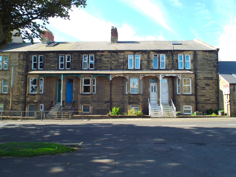
Queen Street.

Town Square, Sundial.
Designed by Patrick Powers and opened 27th May 2001.


Clock Tower War Memorial.
The Clock Tower War Memorial in Amble was designed by Will Burton and unveiled on th 9th May 1925, in dedication to the men of amble lost in the First World War. Inscribed: "TO THE GLORY OF GOD AND IN MEMORY OF THE MEN OF AMBLE WHO FELL IN THE GREAT WAR 1914-1918" and "THE SITE FOR THIS MEMORIAL WAS GIVEN BY E.M. LAWSON-SMITH ESQ IN MEMORY OF HIS TWO SONS WHO FELL IN THE GREAT WAR". A further plaque was later added to the memorial dedicated to those lost in the Second World War.
In the 1970s the Radcliffe War Memorial was relocated from Radcliff near to the Clock Tower in Amble. Both war memorials are Grade p listed. In 2008 the War Memorials Trust provided a grant of £6,239 to repair and restore the Clock Tower War Memorial.
Source: Co-Curate.


Town Square, Radcliffe War Memorial.
The War Memorial was dedicated to the men of Radcliffe in Northumberland who lost their lives in the First World War. It was later also dedicated to those lost in the Second World War. In 1970, most of Radcliffe was demolished before open cast mining began in the area. Most of the population were relocated to Amble and the War Memorial was moved to its new location near the Clock Tower War Memorial in Amble. The memorial is Grade II listed. In 2013 the War Memorials Trust provided a grant of £1,820 towards conservation works to the memorial.
Source: Co-Curate.


St. Cuthberts Parish Church.
Parish church, 1870, by Messrs. Austin and Johnson of Newcastle; south vestry 1929. Roughly-tooled snecked stone with tooled ashlar dressings; roof of small red clay tiles. 4-bay aisleless nave and 2-bay chancel with vestries on north and south. Mid-C14 style.
Chamfered plinth; moulded sill strings and linking hoodmoulds. Stepped buttresses between bays, flanking west end and as angle buttresses at east end. South wall of nave shows boarded double doors in west bay, in double chamfered arch with ogee hood carried up to a finial between 2 quatrefoil panels, in a broad flat-topped projection. Both sides of nave show 2-light windows with varying tracery; a pair of similar but taller windows set high in west end.
On east end a stepped gabled bellcote pierced by two large trefoil-headed arches with a smaller above and between. Slightly-taller chancel has 3- and 2-light south windows, the former above a flat-roofed vestry with 2- and 3-light mullioned windows, and a 3-light east window. Pent-roofed north vestry with small lancets.
All gables have moulded coping and finial crosses. Interior: all walls tooled-squared stone. Double-chamfered chancel arch and similar but smaller arch to organ. Trefoiled piscina and segmental-pointed sedile in chancel. Minton tiles in sanctuary. Carved openwork chancel screen. Moulded font on quatrefoil shaft. Nave roof has collar-beam trusses with upper king-posts and struts; long arch braces, in alternate trusses, on moulded stone corbels; ashlar pieces at eaves.
Source: Historic England.


Percy Street, Trinity Methodist Church.
More Information:
- Historic England: The Vicarage
- Historic England: Clock Tower War Memorial
- Historic England: 3, 5, 7, North Street
- Historic England: 31-39, Queen Street
- Historic England: 41, Queen Street
- Historic England: East Cemetery Entrance Screen and Chapel Spire
- Historic England: Hallbank Well
- Historic England: The Waterloo Public House
- Historic England: Radcliffe War Memorial
- Historic England: Boundary Marker near Cliff Cottage
- Historic England: Ruined Walls east of R.C. Church of Sacred Heart and St Cuthbert
- Historic England: Walls and gate to War Memorial garden
- Historic England: Boundary Marker in lane at rear of No. 6 Coastguard Houses
- Historic England: Gate Piers, Gates and Paddock Walls to north of The Vicarage
- Wikipedia: Amble
- Keys To The Past: Amble
- Co-Curate: Amble
- Northumberland Communities: Amble
- St. Cuthberts Parish Church
See my other photos around Amble:
No comments:
Post a Comment