This walk along the river Tyne from Newcastle Quayside to Lemington point is a little over 4 miles long and is the first leg on my project to walk the river Tyne westwards to Hexham(more on that later). For at least a third of that distance there is no access to the Tyne due to an industrial estate and the former Vickers Factory.
r.jpg)
Leaving Newcastle Quayside.
Looking back you can just make out all 7 bridges in this photo.
r.jpg)
r.jpg)
Looking over the river to Dunston Staiths.
r.jpg)
Just before the Armstrong Business Park.
r.jpg)
r.jpg)
Arches from the now long gone Armstrongs Armaments Factory.
r.jpg)
r.jpg)
r.jpg)

The end of the path along the Tyne for now and up onto Scotswood Road.
r.jpg)
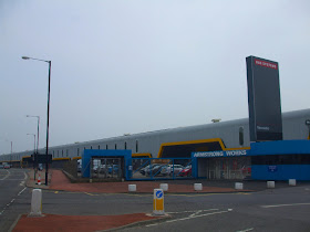
BAE Systems (Vickers Tank Factory), Scotswood Road.

Scotswood Bridge taken from the Gateshead side.
r.jpg)
The old and unused Scotswood Rail Bridge.

The old Scotswood Rail Bridge and the A1M bridge.

The Western Bypass(A1M) bridge.
r.jpg)
The Western Bypass(A1M) bridge.
Kingfisher Boulevard in the background which is the starting point for the next stretch.
The route of my walk.
- Part 1 - Newcastle Quayside to Lemington
- Part 2 - Lemington Point to Newburn
- Part 3 - Newburn to Wylam
- Part 4 - Wylam to Ovingham
- Part 5 - Ovingham to Bywell
- Part 6 - Bywell to Riding Mill
- Part 7 - Riding Mill to Corbridge
- Part 8 - Corbridge to Hexham
Or back to the Walking the River Tyne Westwards Project page.

hi things have changed a lot since the 70s i used to do repair work for Northumberland CC on there bridges,and did much work on Hexham bypass.And Corbridge temperary bridge While the stone bridge was bing repared.
ReplyDeleteI never knew that Corbridge had a temporary bridge.
ReplyDeleteAnyone have any photos of it that they would like to share with us?