Rothbury is a town in Northumberland, located on the River Coquet near the Simonside Hills and the Northumberland National Park, about 25 miles north of Newcastle.
The first mention of Rothbury, according to a local history, was in around 1100 AD, as Routhebiria, or "Routha's town" ("Hrotha", according to Beckensall). An Anglican cross in the town's church is the only surviving pre-conquest remains. The town was retained as a crown possession after the conquest, being made over to the lords of Warkworth in 1204. Rothbury was a relatively important town in Coquetdale, being a crossroads situated on a ford of the river Coquet, with turnpike roads leading to Newcastle upon Tyne, Alnwick, Hexham and Morpeth. It was chartered as a market town in 1291, and became a centre for dealing in cattle and wool for the surrounding villages.
Description courtesy of Wikipedia.
5th August 2009
r.jpg)
r.jpg)
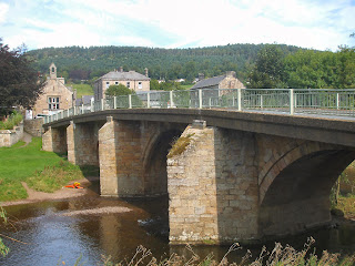
Rothbury Bridge.
16th century date, spanning the River Coquet at Rothbury. The bridge is constructed from squared sandstone masonry laid in regular courses and has four segmental arches, three of which have chamfered ribs and triangular cutwaters. The bridge has a complex structural sequence. It is first mentioned in documentary sources in 1616 but its form suggests it was built in the 16th century.
It was originally a packhorse bridge but was widened for vehicular traffic in 1759 by William Oliphant, whose initials, together with the date, are inscribed on the lower courses of the east side of the bridge. Of the four arches the southernmost one is unribbed and represents a later amendment to the bridges structure. Slight differences in the architectural details of the ribbing, voussoirs and chamfering also suggest phases of structural development, most of which are related to the widening of the bridge in the 18th century.
During the 20th century the parapets were removed and a concrete road deck was placed on the top of the bridge in order to further widen it for traffic.
Grade 2 Listed. Source: Historic England.
r.jpg)
Lady's Bridge.

r.jpg)
r.jpg)
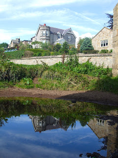
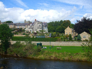
River Coquet.
r.jpg)
r.jpg)
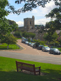r.jpg)
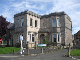r.jpg)
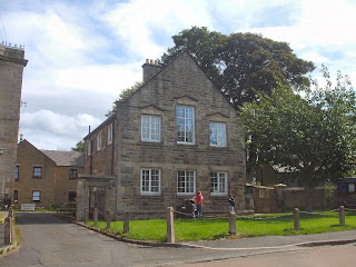r.jpg)
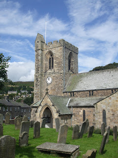
All Saints Parish Church.
All Saints is the parish church of Rothbury. The current church building dates from the 13th century, with restoration in 1850. However, it is a more ancient place of worship; the font in the church has a pedestal which once formed part of an Anglo Saxon cross dating around 800 AD.
Grade 2 listed. Source: Co-Curate.
r.jpg)
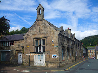
Former Tomlinson School (Rothbury Boys School).
Former school, dated 1841. Tooled stone with cut dressings; blue slates on range fronting Bridge Street, purple slates on range fronting Haw Hill. L-plan. Tudor style. Elevation to Haw Hill. 2 storeys, 2 + 1 bays.
Slightly-projecting gabled part on right shows chamfered plinth and later doorway beneath large 3-light mullioned-and-transomed window with hoodmould. Pointed slit under coped gable on moulded kneelers carrying bellcote with 4-curved arch and moulded finial. Lower left part shows vertical-panelled door on right under 4-centred arch with hoodmould; shield with date above.
Shop window to left in older cart entrance with chamfered jambs and timber lintel, under six-light casement. Coped left gable with rebuilt end stack. 3-bay right return, to Bridge Street shows lower windows with renewed glazing and 2-light mullioned windows in gablets holding 6-pane sashes, except for that to right, lost mullion. The former Tomlinson School, founded on bequest by the vicar of that name.
Grade 2 Listed. Source: Historic England.
r.jpg)
War Memorial.
The War Memorial and drinking fountain on Front Street in Rothbury was unveiled on the 23rd January 1921 by William Watson-Armstrong, 2nd Lord Armstrong (1892–1972). The memorial is inscribed with the names of 41 servicemen from the parish who lost their lives in the First World War. Later, the memorial was further dedicated to 31 people lost in the Second World War, and one lost in the Korean War. The memorial was restored in 2007 and rededicated on the 30th September 2007.
Grade 2 listed. Source: Co-Curate.
r.jpg)
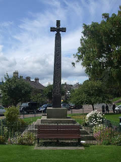
Market Cross.
Market Cross as memorial, by C.C. Hodges. Ashlar. Arts and Crafts style. 4 steps up to square base inscribed 'This Monument was erected in the year 1902 on the site of the ancient market cross by the inhabitants of Rothbury and other Friends in admiration and grateful rememberance of the long and useful lives of William George Baron Armstrong of Cragside G.B. (1810-1900) and of Margaret his wife (1807-1893)'.
Tall tapering shaft with oak scroll inhabited by stag, squirrels and birds; Celtic cross head with central boss. Right side of shaft shows various knotwork and key patterns and left side a vinescroll; rear face has rose scroll with rabbits and birds. Overall height 6.9 metres. The cross stands on a square of paving with projecting blocks at the corners and on each side, which have carried iron standards for a former railing.
Grade 2 Listed. Source: Historic England.
r.jpg)
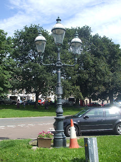
Donkin's Lamp.
Opposite the Market Cross and just in front of the United Reform Church in the centre of the village stands an interesting light. Known today as Donkin's Lamp it was proposed in 1902 by Robert Donkin, chairman of the group charged with the erection of the Armstrong Memorial Cross. He offered to erect s gas lamp at his own expense to celebrate the coronation of King Edward and Queen Alexandra.
r.jpg)
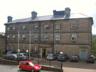
Rothbury House.
Known as the "County" Rothbury House was originally named "Rothbury Hotel" and opened in 1789 as a private hotel and is now owned and managed as a convalescent home by the Royal Air Forces Association.
Source: Rothbury.co.uk
r.jpg)
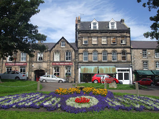
Model Buildings.
A terrace known as Model Buildings because they represented 'state of the art' workers' housing of the 1890's.
r.jpg)
r.jpg)
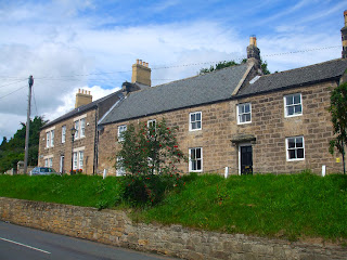
Town Foot.
r.jpg)
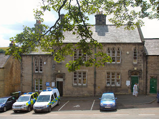
High Street.
r.jpg)
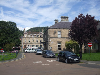
Church Street.
Panoramic Photographs.
More Information:
- Northumberland Communities - Rothbury
- Wikipedia - Rothbury
- Northumberland Cam - Rothbury
- Northumberland National Park - Rothbury
- Keys To The Past - Rothbury
- Co-Curate - Rothbury
- Historic England - Rothbury
- Historic England - Church of All Saints
- Rothbury.co.uk - Donkin's Lamp
See my other photos near Rothbury:


No comments:
Post a Comment